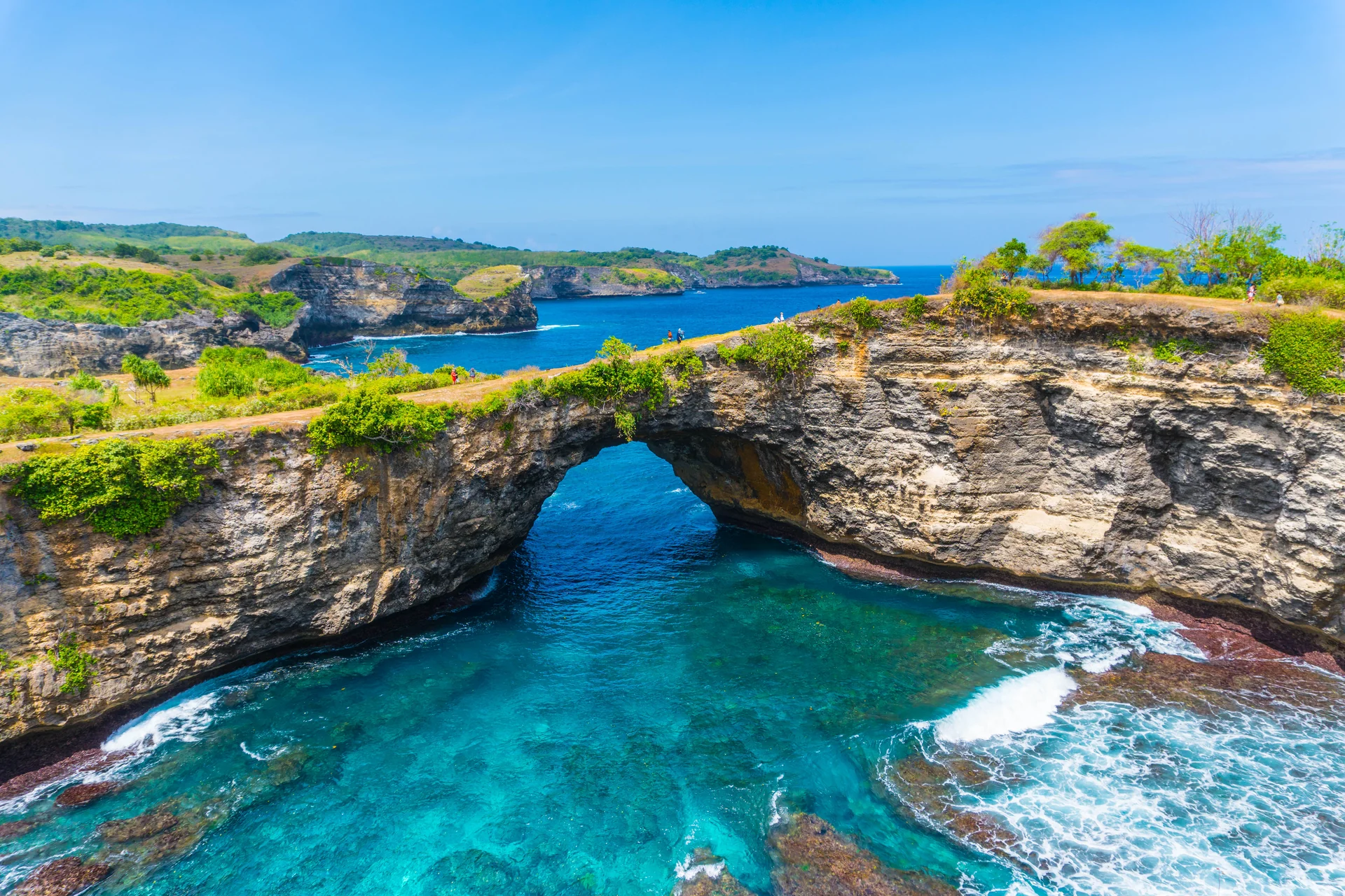
Coastal arch
The tourism sources describe a rock opening and cove. The formation does not establish a permitted walking route.
 BROKEN BEACHNUSA PENIDA GUIDE
INDEPENDENT · NON-PROFIT GUIDE
Pasih Uug · Nusa Penida · Bali
A coastal arch and cove, not permission to descend or enter the water.
Use this guide for orientation and preparation. Check current paths, cliff access and services on your visit day.
2017 reference photograph; current conditions and access may differ. Aaron Rentfrew / Wikimedia Commons · CC BY-SA 4.0 · resized/re-encoded; CSS crop
ORIENTATION
Klungkung Tourism (25 April 2022) describes Pasih Uug as a coastal hollow with a rock opening connected to the sea. We do not treat the article’s diameter and age descriptions as precise measurements. Pasih Uug is also used for Broken Beach.
READING THE PLACE
The tourism sources describe a rock opening and cove. The formation does not establish a permitted walking route.
The 2022 tourism article associates the hollow with erosion and limestone collapse. This is a source summary, not a new geological survey.
Follow open paths and local directions; an old photograph or calm-looking surface does not establish safe access.
NAME, STONE & STORY
This page separates landscape explanation from oral memory. That distinction helps visitors value a place without treating a story as geological evidence.
Klungkung Tourism published its Pasih Uug overview in 2022; exact dimensions and formation dates are not established here.
Pasih Uug and Broken Beach appear together in the linked government sources.
Nusa Penida District published a formation folktale on 14 December 2020. Read it as a cultural legend, not an event history or geological evidence.
BEFORE YOU GO
Operating conditions can change with weather, access works, or local rules. Use the notes below to shape a plan, then confirm on site on the day of your visit.
The Maps listing checked on 19 October 2026 supplied no hours we could verify. Do not infer 24-hour opening or permission for night access.
Allow 45–60 minutes as a planning suggestion for orientation from permitted areas, not an official duration. Add travel time and check access.
Current charges are unverified. Ask whether area access, parking or other services are charged, what is included and what receipt is provided.
Maps on 19 October 2026 marked no wheelchair-accessible entrance. This is a listing field, not an audit of every route. Ask about paths and assistance needs before travelling.
Treat services along the coast as basic support, not a guarantee. Capacity and availability can shift with time, weather, and local arrangements.
Ask about location, hours and condition; do not assume facilities exist along every path.
Confirm location, capacity and charges with staff; the map pin is not evidence of parking or an entrance.
Prepare journey essentials subject to venue rules. Operating outlets and menus have not been verified.
Compare accommodation locations with the harbour actually used and the day’s route.
Ask about payment methods and pack personal essentials before travelling; nearby services are not guaranteed.
Check service points with providers when planning the route; do not assume vehicle charging at the site.
GETTING HERE
If starting on mainland Bali, confirm a crossing to Nusa Penida and an onward road journey. Check harbour names, schedules, fares and travel duration with operators for your date.
Arrange ground travel to the harbour confirmed by the operator.
Check sailing status, schedule, baggage and arrival harbour with the operator.
Confirm transport, meeting point and the return plan before continuing.
Use the map for orientation, then follow current signs and access restrictions.
If arriving through DPS, check road and sea connections separately; no connection duration is guaranteed.
Check services actually operating on your date, including weather and passenger conditions.
Agree pickup, fare, destination and return arrangements with the provider.
A direct network and timetable to this place have not been verified. Ask an operator or transport authority before relying on a connection.
Location map
Use the pin for location orientation, not as a verified entrance or route. Check current signs and barriers on site.
Open locationAROUND THE COAST
A coastal-pool formation separate from Broken Beach’s cove and arch. Low tide or a model forecast does not grant water-entry permission; check access and rules separately.
Another Nusa Penida itinerary candidate. Check its own route, hours and access; Broken Beach information does not automatically apply.
Named in the 2026 government-visit report. It is a separate itinerary candidate, not a guarantee of current access or water activities.
Check food, water, payment methods and personal essentials when planning the journey. No current business directory or menu has been verified here.
REGIONAL MODEL DATA
Regional Open-Meteo data, not a sensor in the cove. Model sea level is unsuitable for coastal navigation, judging breaking waves at the edge, or deciding water entry. Follow closures and staff instructions regardless of model values.
Open-Meteo · DWD / Météo-France · Model documentation and limits · WITA (UTC+8)
FREQUENTLY ASKED QUESTIONS
Maps on 19 October 2026 lists 7F82+R4, Sakti, Nusa Penida, Klungkung, Bali 80771, pin -8.7327938, 115.4508319. A 16 February 2026 regency report uses Bunga Mekar village. These descriptions are not combined into a boundary or entrance audit.
The Maps listing checked on 19 October 2026 supplied no hours we could verify. Do not infer 24-hour opening or permission for night access.
Current charges are unverified. Ask whether area access, parking or other services are charged, what is included and what receipt is provided.
Do not treat the cove as a swimming place or look for a descent based on old photographs. Use only permitted paths and check local restrictions.
A coastal-pool formation separate from Broken Beach’s cove and arch. Low tide or a model forecast does not grant water-entry permission; check access and rules separately.
Maps on 19 October 2026 marked no wheelchair-accessible entrance. This is a listing field, not an audit of every route. Ask about paths and assistance needs before travelling.
Availability, capacity and fees are unverified. Ask staff about your needs; do not assume the pin marks an entrance, parking or a level path.
Allow 45–60 minutes as a planning suggestion for orientation from permitted areas, not an official duration. Add travel time and check access.
No such permission has been verified in this guide. A photograph of someone in a location is not access permission. Follow local rules and ask staff.
No. Regional model data are not cliffside measurements, water-entry permission or a safety guarantee. Follow closures and local directions.
KEEP EXPLORING
Sources are dated and scoped in the source section. This site is not the operator and does not sell tickets.
2017 reference photograph; current conditions and access may differ. Aaron Rentfrew / Wikimedia Commons · CC BY-SA 4.0 · resized/re-encoded; CSS crop